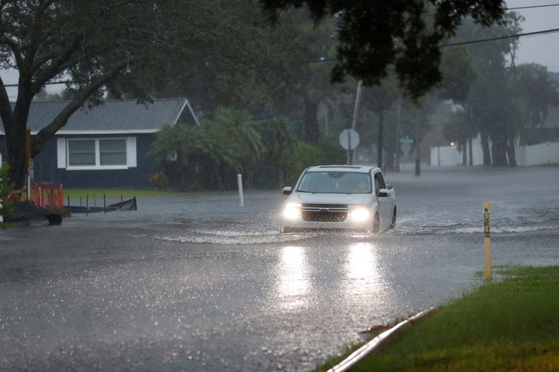
Debby, now a tropical storm, soaks northern Florida, churning toward Georgia
By Maria Alejandra Cardona
STEINHATCHEE, Fla. (Reuters) -Tropical Storm Debby dropped buckets of rain across northern Florida on Monday afternoon as it plodded toward Georgia and the Carolinas, where forecasters expect the downgraded hurricane to bring a week of torrential downpours and catastrophic flooding.
The storm had lost some of its windspeed after slamming Florida's Gulf Coast around 7 a.m. on Monday morning as a Category 1 hurricane. It made landfall near Steinhatchee, in the Big Bend region about 70 miles (115 km) southeast of Tallahassee, delivering winds of up to 80 mph (130 kph), the National Hurricane Center said.
The hurricane center predicted Debby would move offshore into the Atlantic by Tuesday night, then re-strengthen and come back inland to drench the coasts of Georgia and South Carolina later in the week.
The center forecast "catastrophic flooding," with local areas along Georgia and South Carolina's coastline receiving 20 to 30 inches of rain by Friday morning. The governors of Georgia and South Carolina have declared states of emergency in anticipation of Debby's damage.
"This is going to be an event that is going to be probably here for the next five to seven days, maybe as long as 10 days, depending on how much rainfall we get," said Florida Division of Emergency Management Executive Director Kevin Guthrie.
By midday Monday, Debby had already dumped eight to 16 inches of rain in some parts of central Florida, according to local weather reports.
Hours after the storm's landfall in Steinhatchee, heavy rains were still falling on the beach town, and bayfront restaurants were flooded.
Further south in Hillsborough County, rescue crews in Tampa recovered the body of an 18-wheeler truck driver who had lost control of the vehicle on Interstate 75 and went into the Tampa Bypass Canal, local TV station WTSP reported.
Roughly 240,000 customers were without power in Florida, according to Poweroutage.us, and flight trackers showed hundreds of flights originating from and heading to Florida airports were canceled on Monday.
SLOW DRENCHING
A slow-moving tropical storm as it passed over Cuba, Debby gained strength from exceptionally warm Gulf waters as it paralleled Florida's Gulf Coast on Sunday.
Debby bears some of the hallmarks of Hurricane Harvey, which hit Corpus Christi, Texas, in August 2017. Downgraded to a tropical storm as it moved inland, Harvey lingered over Texas, dumping about 50 inches of rain on Houston and causing $125 billion in damage.
Climate scientists believe man-made global warming from burning fossil fuels has raised the temperature of the oceans, making storms bigger and more devastating.
The last hurricane to make a direct hit on the Big Bend region was Hurricane Idalia, which briefly gained Category 4 strength before making landfall as a Category 3 in August 2023, with winds of more than 125 mph. The National Centers for Environmental Information estimated $3.5 billion in damages. DeSantis described the initial effects of Debby as "modest" compared with Idalia.
Forecasters expect numerous Atlantic hurricanes in the 2024 season, which began on June 1, including four to seven major ones. That would exceed the record-breaking 2005 season that spawned the devastating Katrina and Rita hurricanes.
Only one hurricane, Beryl, has yet formed in the Atlantic this year. The earliest Category 5 storm on record, it struck the Caribbean and Mexico's Yucatan peninsula before rolling up the Gulf Coast of Texas as a Category 1 storm, with sustained winds up to 95 mph.
Source: Investing.com
